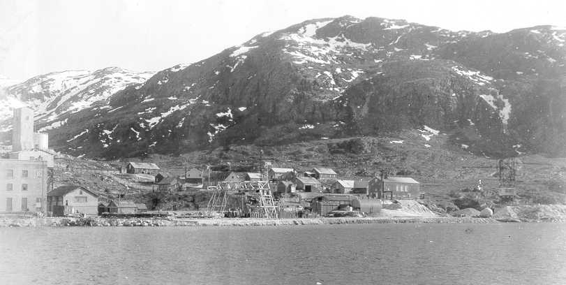
Bluie East 1
Prince Christian Sound, Greenland
Active: 1941-1947
Wikipedia: Prince_Christian_Sound
Primarily a weather station

Photo by Jens Bludau
This map shows the locations of all U.S. military and scientific research locations on Greenland, past and present. Most were installed during World War II. Some later. The blue markers represent current bases. The red markers are for bases that were removed or turned over to the Greenland-Denmark government.
The code names for some of these bases is Bluie. This name is arbitrary and has nothing to do with Greenland.
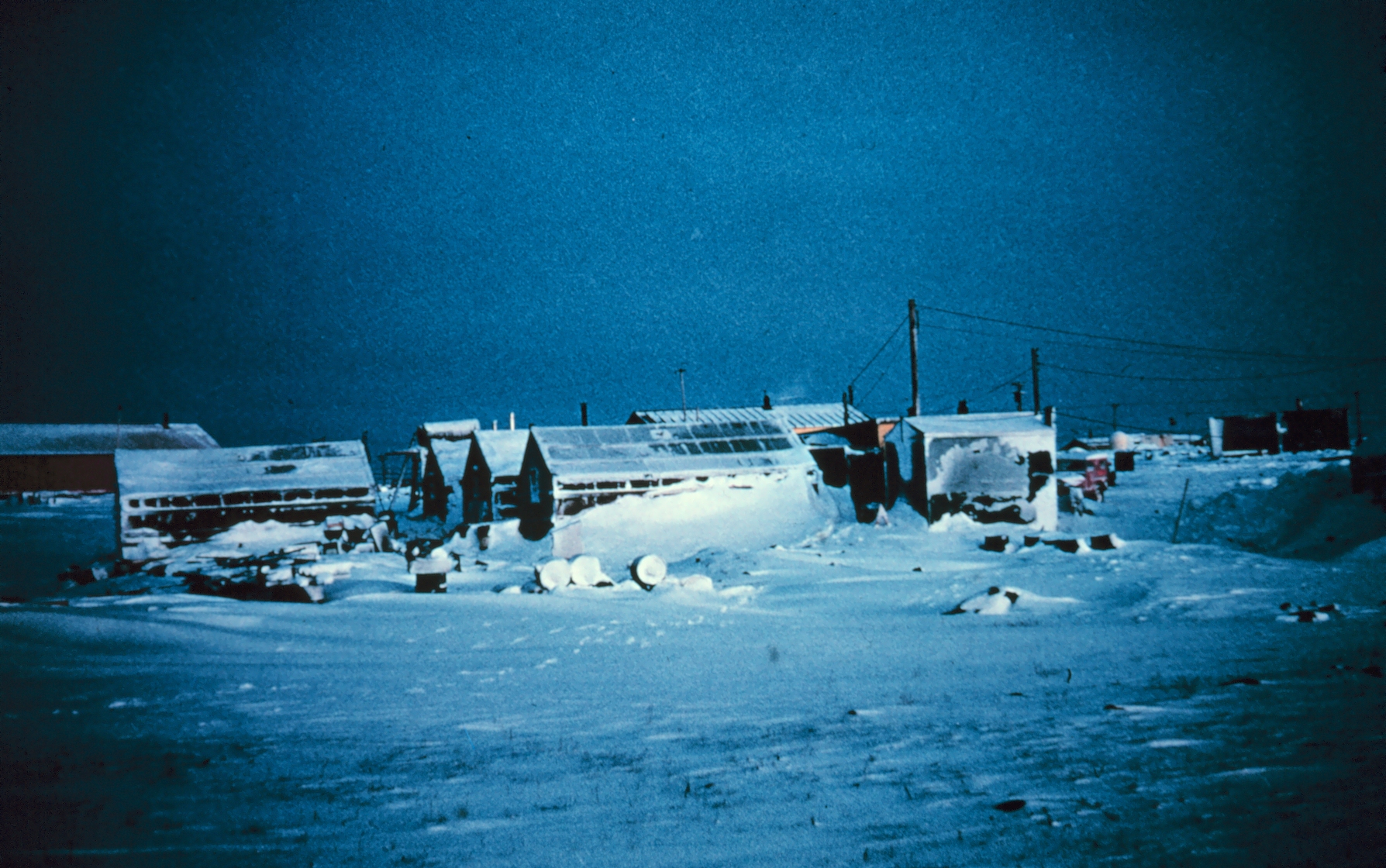
Prince Christian Sound, Greenland
Active: 1941-1947
Wikipedia: Prince_Christian_Sound
Primarily a weather station
Ikateq, Greenland
Active: 1941-1947
Wikipedia: North Atlantic air ferry route in WWII
This was an airfield and weather station.

Scoresby Sound, Greenland
Active: 1941-1947
This was a radio and weather station

Ella Island, Greenland
Active: 1941-1947
radio and weather station

Clavering Island, Greenland
Active: 1941-1947
This is the original Bluie East Five
The Island was nicknamed Eskimonæs
This was a radio and weather station.
Myggbukta, Greenland
Active: 1941-1947
This was a radio and weather station
aka: Narsarsuaq International Airport
Narsarsuaq, Greenland
Active: 1941-1958
Wikipedia: Narsarsuaq_Air_Base
Wikipedia: North Atlantic air ferry route in WWII
airfield, radio and weather station
About 4,000 American servicemen were stationed there, living in an area norheast of the airfield called Hospital Valley.
Bluie West One is sometimes abbreviated BW-1.
PBY Catalina patrol planes were stationed there.

Simiutaq, Greenland
Active: 1941-1947
This was a radio direction finding station.
aka: Teague Field
Marrak Point, Greenland
Active: 1942-1945
This was an airfield, radio, and weather station.
Don't see anything that looks like an airfield at the marker location
Assiaat, Disko Island, Greenland
Active: 1942-1945
This was a radio and weather station.
aka: Pituffik Space Base
aka: Thule AFB
Pituffik, Greenland
Active: 1943-Present

aka: Kangilinnguit
aka: Gronnedal
aka: Green Valley
aka: Navy 26
Ivigtut, Arsuk Fjord, Greenland
Active: 1940-1951
Link: Reuters: Denmark spurned Chinese offer for Greenland base over security - sources
North Atlantic Route
PBY5 Catalina patrol aircraft operated from this location during WWII.
In 2016, the Chinese mining company General Nice Group offered to buy the base, but the Danish government rejected the offer because of the United States.
aka: Sondrestrom Air Base
Kangerlussuaq Fjord, Greenland
Active: 1941-Present
Wikipedia: Sondrestrom Air Base
Wikipedia: North Atlantic Route
This was a SAC base, now Air National Guard
This was part of the Crimson Route.

aka: Cruncher Island
Simiutak Island, Greenland
Active: 1941-Present
This was a radio communications facility.

Icecap, Greenland
Active: 1959-1966
This was an underground city in the ice.

Icecap, Greenland
Active: 1957-1960
This was a U.S. Army research camp.

Qaasuitsup Municipality, Greenland
Active: 1954-1966
Link: Lisa Murkowski visits Camp Tuto
Link: Camp TUTO Sixty Year Anniversary
Link: Ray Hansen's recollections from 1955-58

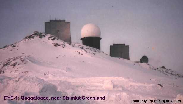
Qaqqatoqaq, -near Sisimiut, Greenland
Active: 1957-1988
Tactical callsign: Red River
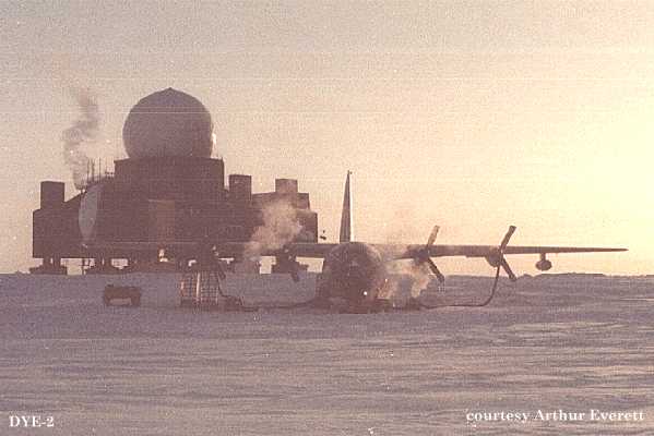
Greenland-ICE CAP 1, Greenland
Active: 1957-1988
Tactical callsign: Sea Bass
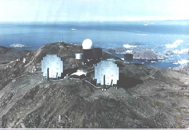
Greenland-ICE CAP 2, Greenland
Active: 1957-1988
Tactical callsign: Sob Story

Kulusuk, Greenland
Active: 1957-1991
Tactical callsign: Big Gun
Shannon Island, Greenland
Active: 1944-1944
German weather station
Little Koldewey Island, Greenland
Active: 1944-1944
Link: Operation Edelweiss (ii)
German weather station
Hansa Bay on Sabine Island's northeast coast, Greenland
Active: 1942-1943
German weather station
Kulusuk, Greenland
Active: 1957-1991
Frederiksdal, Greenland
Active: 1943-1984

Qaasuitsup Municipality, Greenland
Active: 1952-1966
This was a military and scientific station.
This was a U.S. satellite tracking station, part of Satellite Triangulation Program.
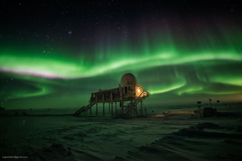
Northeast Greenland National Park, Greenland
Active: 1989-Present
The station is located at 3,216 metres (10,551 ft) above sea level at the apex of the Greenland ice sheet. It is a research facility run by the United States National Science Foundation.

This is a link to the Joint Committee Annual Report 2011 that documents the relationship between Greenland, Denmark, and the United States.
The Long Blue line: Greenland—Coast Guard’s Arctic combat zone of World War II, 1940-41